01 / SOLAR
☼
Solar Field Inspections
Thermal anomaly screening, aerial overviews, visual module and equipment observations, and documented areas for targeted follow-up.
Enterprise aerial mapping, 3D site models, thermal inspections, aerial photography and asset-condition documentation for renewable energy sites, construction projects and utility infrastructure.
Our drone team supports inspections, progress tracking and site assessment without requiring extensive ground access to every location. Deliverables are tailored to the project: orthomosaics, site photographs, 3D photogrammetry products and documented inspection findings.
Inspection and data-collection services for infrastructure owners, operators, construction managers and contractors.
Thermal anomaly screening, aerial overviews, visual module and equipment observations, and documented areas for targeted follow-up.
Visual site condition inspections, project documentation and mapping for renewable energy projects beyond solar.
Existing-conditions documentation, aerial progress tracking, site mapping, earthwork visual records and 3D modeling.
Visual inspections of accessible overhead-line infrastructure, right-of-way conditions and pole-line documentation, subject to site and airspace constraints.
Overlapping imagery, orthomosaic creation and photogrammetric models for planning, monitoring and project communication.
Screen for temperature anomalies and document observations for qualified field diagnosis and follow-up electrical testing.
CNR operates a DJI Matrice 4E, Matrice 4T and Mavic 3 Enterprise with two FAA-certificated remote pilots.
Aerial photography, image collection, mapping, photogrammetry and 3D-model workflows.
Thermal and visual survey missions for solar anomalies, infrastructure observation and asset documentation.
Portable aerial mapping, site imagery, construction progress and photogrammetric data collection.
Three examples from actual CNR flights show how thermal diagnostics, visual inspections and progress photography can provide usable information for EPC teams, site owners and field crews.
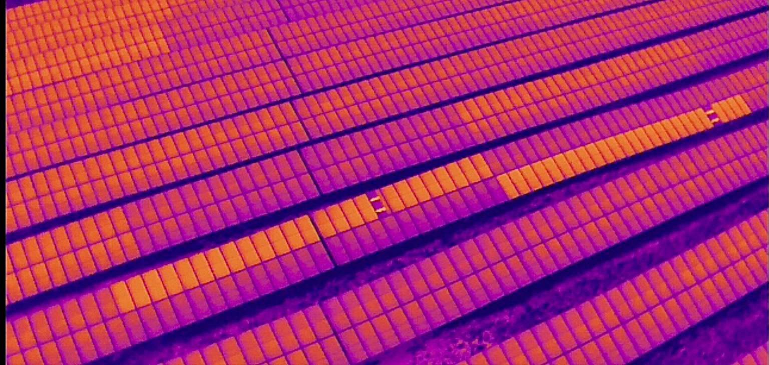
A two-minute thermal flyover identified two PV modules with heat signatures that differed from surrounding modules. CNR repositioned the drone above each anomaly to guide a ground electrician directly to the affected modules.
The electrician confirmed that each affected module’s leads had been connected together and the modules were not connected into a string. The flight helped move quickly from aerial detection to a verified electrical finding.
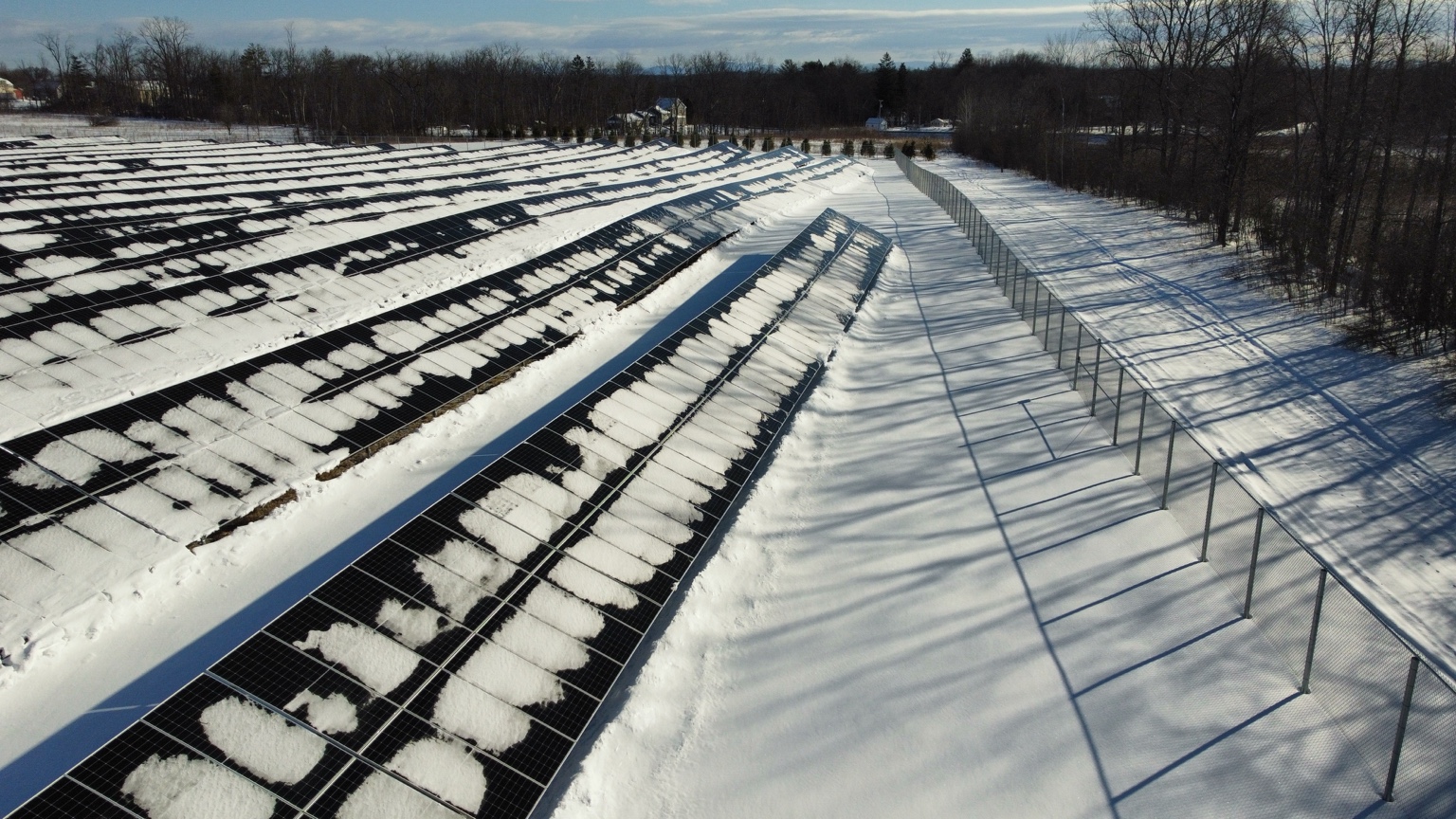
After an EPC identified an underperforming inverter, CNR conducted a mid-morning February aerial review. The images documented tree shadows across the array as well as seasonal snow cover.
The investigation confirmed that shading from trees south of the array caused the decreased performance. Solar access was then reviewed and several trees were removed to reduce shading. No post-removal energy gain is claimed without measured production data.
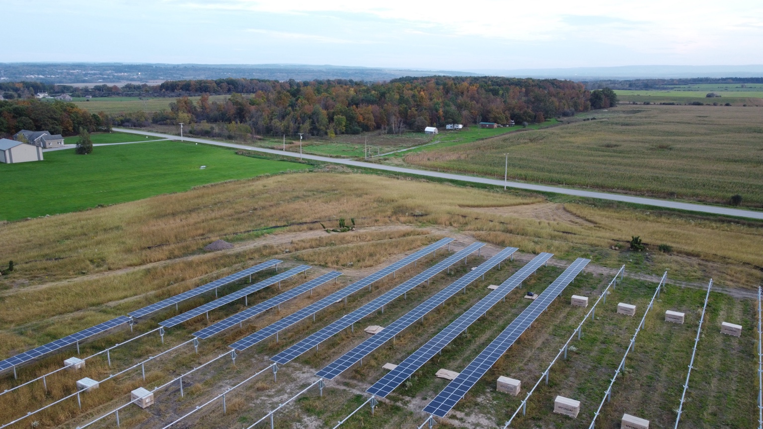
Drone photography documents the installation of modules and racking from a sitewide viewpoint. In this image, completed and partially assembled rows are visible alongside areas awaiting further work.
Repeatable aerial capture can support progress meetings, owner updates, milestone documentation and construction coordination. It can also be paired with orthomosaic mapping or 3D modeling when specified.
The featured photos are from actual CNR inspections and construction documentation. Flight imagery and visual findings do not replace appropriate electrical field testing or measured performance verification.
Site maps, high-resolution orthomosaics, 3D models and photo datasets as scoped for the mission.
Annotated visual and thermal observations, location references and recommendations for ground verification.
Dated aerial photographs, site-overview records and repeat-visit photo comparisons.
Aerial infrared inspections can identify temperature anomalies but do not, by themselves, conclusively diagnose microcracks or internal module defects. Flights and deliverables depend on airspace authorization, weather, site conditions, equipment configuration and project-specific requirements. Mapping products are not represented as licensed land surveys.
Tell us the location, asset type, acreage or corridor length, inspection objectives and preferred deliverables.